a million steps
one family's journey
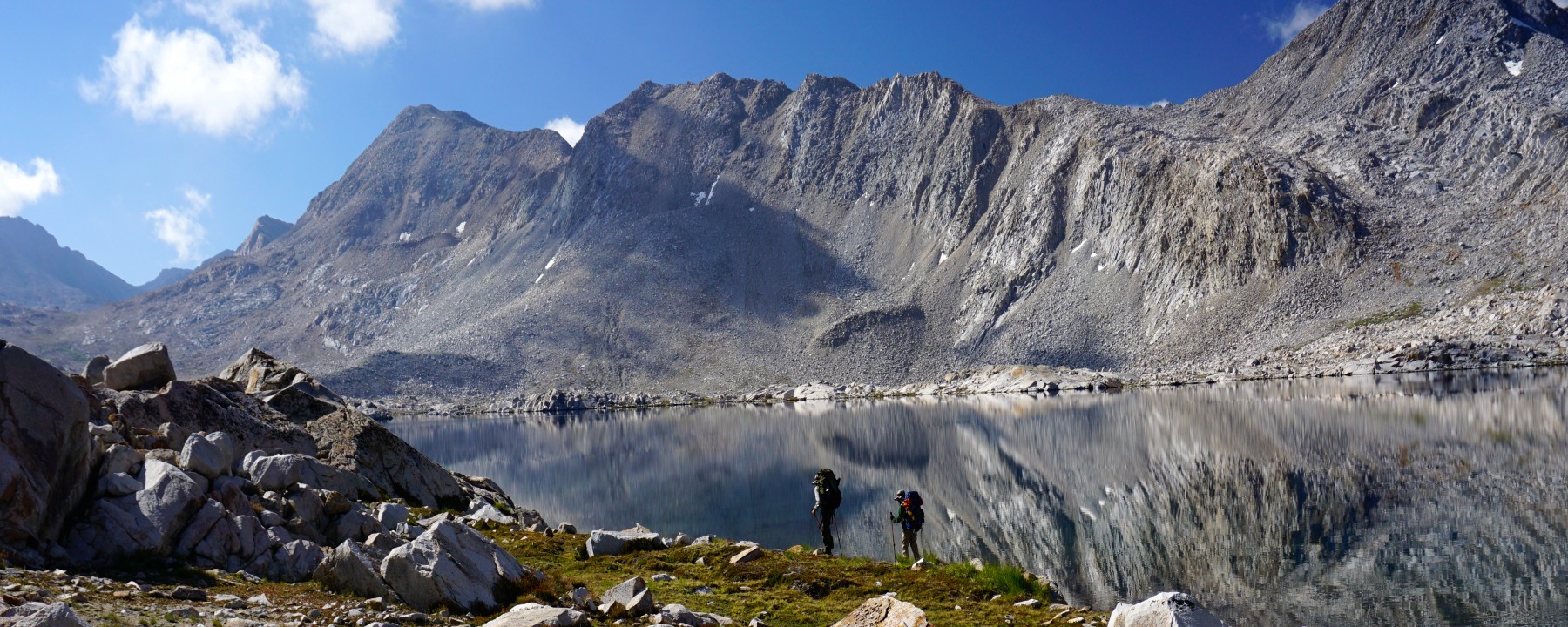

From August 3 – August 10, 2016, we hiked along the route outlined in chapter 3 (Whitebark Country) of Steve Roper’s book, Sierra High Route (SHR). This was our first big off-trail hike and we were super excited. We journeyed from the South Lake trailhead, up and over Muir Pass and then headed off trail just below Evolution Basin. From there we explored the Darwin Basin, found our way to Lake 11,092′, up and over Snow Tongue Pass and on to Humphreys Basin, over Puppet Pass and into French Canyon. Our time on the SHR was amazing and humbling. Read about our journey here.
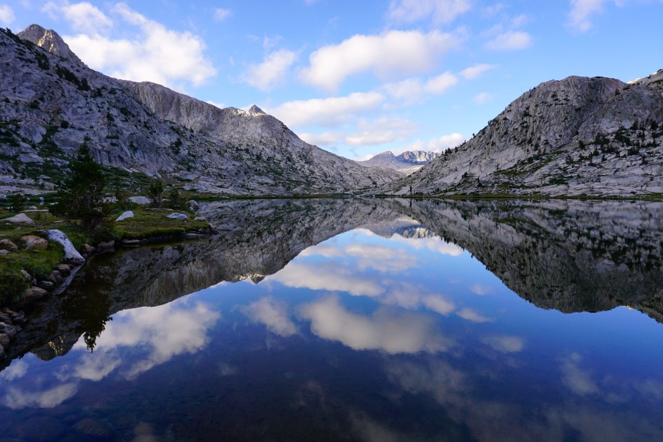
Evolution Lake
Summer backpacking season is upon us once again and in a few short weeks, our family will be hitting the trail — or not, as I will explain shortly — and heading back into the wilderness. We would happily spend another month backpacking this summer as we did last summer on the JMT, but we chose to take on a different challenge: going off-trail and navigating a section of the Sierra High Route. I have booked permits for a 10 day trip beginning August 3 and I will be posting more about our route, preparation, new gear, etc. in the coming weeks. Stay tuned…
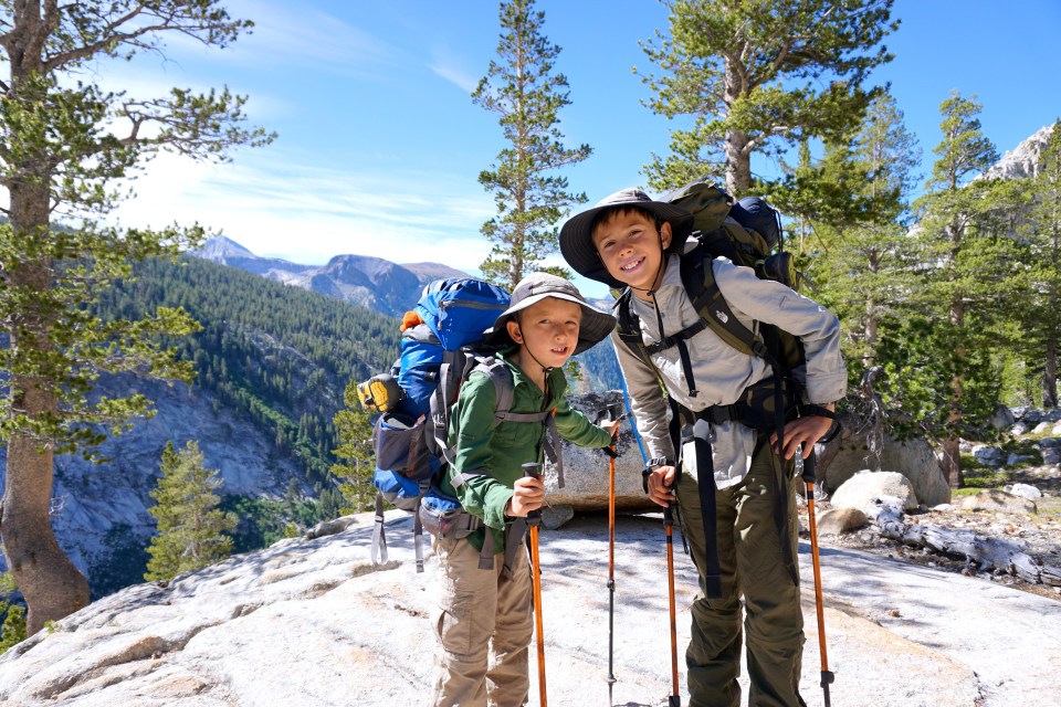
My family of 4 hiked the John Muir Trail in July 2015. We are still on a high from that trip. Even now, four months later, our conversations at home routinely roll around to discussions about trail food, the best campsite we had on the trail, or which lake had the most trout. We have hung photos of our trek around the house and each of us pauses to take them in as we pass by on our way to some other part of the house. Lately, our discussions have shifted from the last trip we took to the NEXT trip we will take. We all agree that we will hike the JMT together again. It was just that awesome. But for 2016, we are considering a few alternate trips:
Sierra High Route
The Sierra High Route (aka the Roper Route) is a cross-country trek, stretching for 195 miles through the Sierra Nevada. Steve Roper first scouted this trail and wrote a useful book Sierra High Route: Traversing Timberline Country.
The Sierra High Route (SHR) runs parallel to the John Muir Trail for most of the distance but the beauty of this route is that the SHR stays above the timberline, between 9,000 and 11,ooo feet in elevation. This is the zone where everyone in my family feels most at home and where we best experience the power and the beauty of the Sierra Nevada.
The route follows maintained hiking trails (with 28 miles of those on the JMT) but more than two thirds of the Sierra High Route runs off-trail over granite slabs, through meadows and even includes some rock scrambling. If we choose this route for our next big trip, we will need to rely heavily on maps and a GPS. We have not attempted a cross-country (off trail) hike so we will need to get in a few small trips prior to taking a bite out of the Sierra High Route. We also would need to plan which section of the SHR we want to tackle in a 7-10 day trip. Very appealing.
High Sierra Trail
Not to be confused with the Sierra High Route, the High Sierra Trail runs from west to east through Sequoia National Park, CA, and crosses the Sierra Nevada range. The trail runs 48.4 miles from Crescent Meadow in the Giant Forest region of Sequoia National Park to the junction with the JMT and PCT in the east.
This hike appeals to me because I think we could tackle it in 7-10 days without resupply. As I have mentioned in the section “backpacking with kids,” carrying food weight for 4 people with only two adults doing the heavy lifting is a hugely limiting factor. My husband and I can comfortably carry 7 days of food for the four of us. If we have to carry more than a 7 day supply we are forced to ditch weight by reducing our food load. This happened to us on one stretch of the JMT and it left us all hungry for a few days on the trail. Not good and not something we want to repeat.
